
We utilize the latest in geophysical techniques to unlock high level workflows, impact and value
UMS’s strategic approach to Subsurface Utility Engineering (SUE) is designed with each phase increasing in the intensity of designation and delineation campaigns.
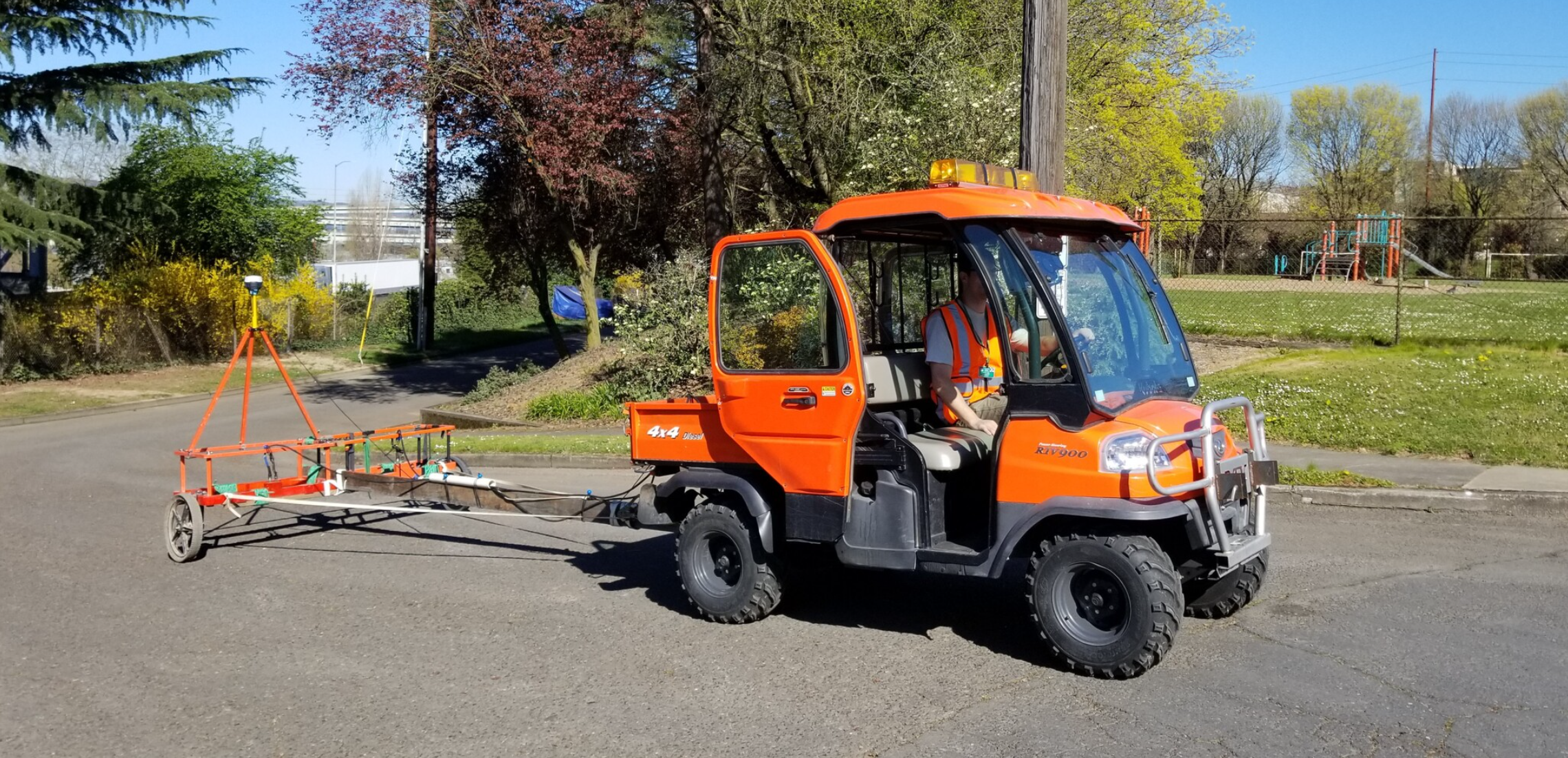
Our SUE Phase I operations for a project, also referred to as utility designating or the Quality Level (QL) B mapping effort, is generally meant to provide designers a 2D map of existing utilities based on records research, field investigation, and the use of conventional pipe and cable locators paired with GPS survey methods.
The Phase I work includes efforts and processes to achieve the highest quality levels (QL, in accordance with CI/ASCE 38) practical without vacuum excavation methods, and generally targets a QL B designation which provides horizontal accuracies sufficient for most preliminary design activity.
The Phase I data set generally can result in a mixture of CI/ASCE 38-02 QL D and C for installations that are not readily detectable with standard electromagnetic (EM) equipment, QL B for standard EM detectable infrastructure, and QL A for discrete points where infrastructure is exposed or accessible from the surface.
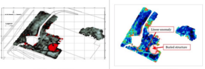
The Phase I designated utility data is provided to the project design team for preliminary design and conflict evaluation, and to identify locations where more detailed data is required.
UMS is a standards driven organization and we are constantly defining how organizations capture, measure, and memorialize our clients infrastructure.
