
Why We Engineer
Engineered Solutions reduce utility-related risk to projects using the very best methods and technologies to 1) build the Common Operating Picture; 2) analyze project designs and flag issues, and 3) implement value- engineered and innovative strategies that mitigate utility impacts and optimize project delivery. We transform utility management from inefficient reactive construction struggles into efficient proactive engineering that expedites construction, reduces risk and costs, and mitigates public discomfort. Our Engineers have a reputation for excellence in:
- Investigating, depicting, and mapping utilities in accordance with ASCE 38/75 standards;
- Documenting facility condition and notifying concerned parties;
Processing and managing utility data using OGC-compliant, GIS-friendly technologies; - Analyzing and resolving issues while building relations through professional utility engineering whereby the public welfare is held paramount over all other interests;
- Engaging stakeholders (e.g., project owners, design team, utility operators, public and commercial interests) while coordinating the resolution process;
- Overseeing or developing utility designs and specifications as required;
Estimating costs and tracking work for utility conflict avoidance, accommodation, and relocation; - Implementing utility data management strategies and technologies; and
- Bid document preparation and construction support.
Our engineered solutions are an absolute requirement for an organization to successfully implement subsurface utility engineering protocols
1
RECON
Phase 1 site investigations coordinate project stakeholders and discover existing information that is required to ensure field operations proceed efficiently and effectively and that we can provide accurate cost estimates for our clients.
2
FIELD OPERATIONS
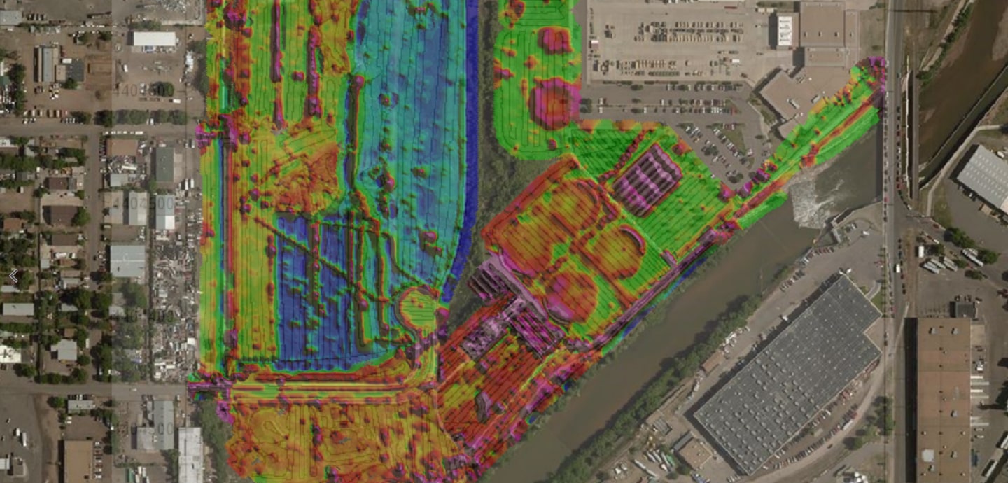
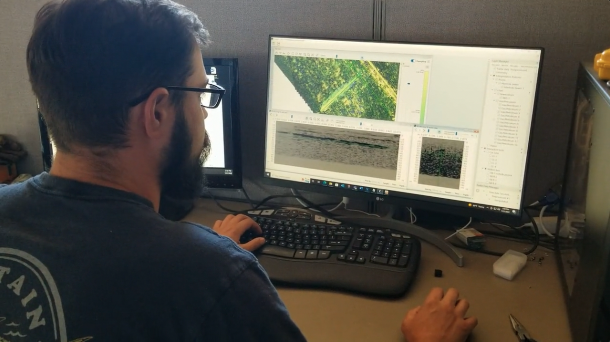
UMS deploys its broad array of geophysical and survey techniques to non-destructively map all features within a survey area. This data is a snapshot of the current state of infrastructure fully geo-referenced for accurate and reliable integration with operational groups within an organization.
3
ENGINEERED SOLUTIONS
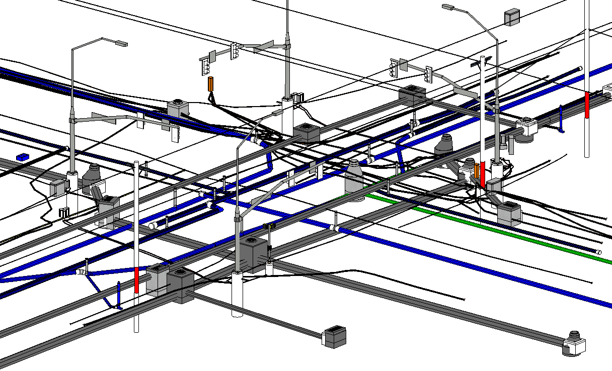
Collected data is processed to create detailed 2D and 3D models of all infrastructure across a project area. Our engineers work closely with counterparts at our client organizations and develop recommendations for additional data collection and engineered solutions to highlighted issues. These models form the basis for integration with other source systems across an organization.
4
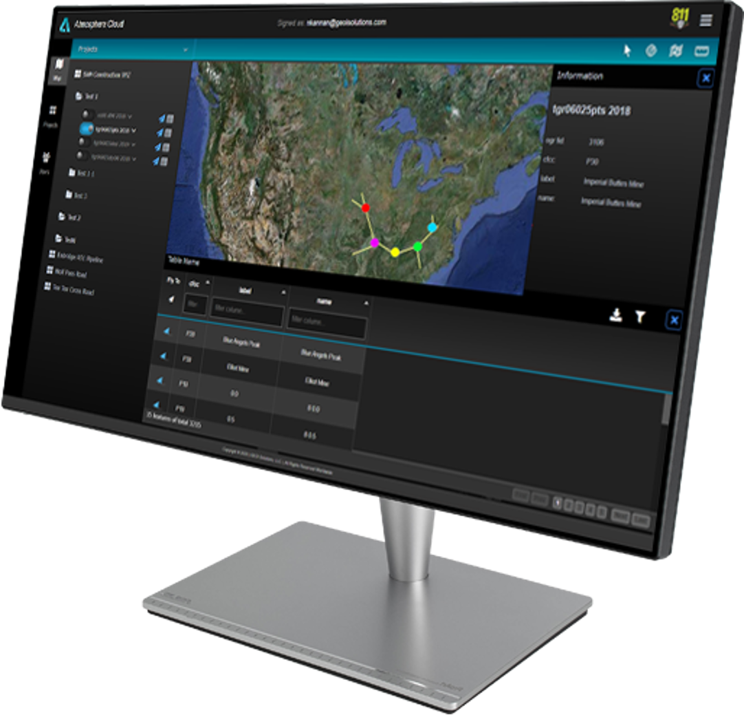
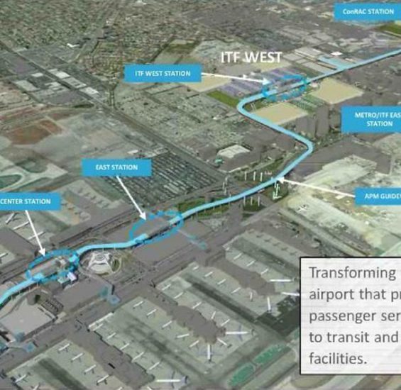
COMMON OPERATING PICTURE
Integration of the developed models with other data sources through our GeoFeature™ data management suite of products to create a Common Operating Picture (COP). Breaking down information silos and allowing an organization to work cross functionally unlocks the highest impacts to enable full value realization.
5
WORKFLOW ACTUALIZATION
The COP developed through GeoFeature™ becomes the foundation for development of complex data powered workflows across an organization.
