
Archives: Services
Service Description
Geophysics for Engineering
Bathymetric Surveying
Field Designation
NORBIT SONAR
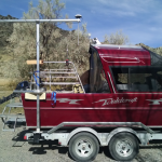
The NORBIT Wide Band Multibeam Sonar (WBMS) is the most compact high resolution wide-swath multibeam sonar available. With a sonar dry-weight of less than 4.5kg (10lbs), beam widths of only 0.9°, and low power draw the stand-alone multibeam sonar easily mounts to any sized survey platform and may be powered by a small battery (ex. laptop extension battery pack) or standard AC plug.
The WBMS emits a frequency modulated (FM) sound wave centred at 400kHz (the optimized frequency). From the returning sound energy, 256 or 512 beams are formed within a user-selectable 5° to 210° fan shaped swath using the integrated sound speed probe and curved receiver array that allows for narrow beams with significantly less beam spreading than linear arrays. Repeatable bottom detections from 0.2m to 280m (Seattle, WA USA – salinity @ 29ppt – water temperature 11°C) are determined using automatic gain compensation, adaptive gating technology, and amplitude and phase proprietary algorithms for bottom detections. All processing and export of time-stamped bottom detection occurs within the sonar head.
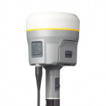
EOS Arrow 200
The EOS Arrow 200 is the world’s first GNSS receiver with the ability to provide 1cm real-time accuracy to all major mobile devices, this includes; Android, iOS, Windows, and Windows Mobile devices.
It’s internal GNSS engine picks up all of the global satellite constellations GPS, GLONASS, GALILEO, and BeiDou making it a perfect solution for a network RTK rover.
Trimble R8 GNSS System
The Trimble® R10 GNSS System is built with powerful technologies integrated into a sleek design, this unique system provides surveyors with a powerful way to increase productivity in every job, every day.
- Trimble CenterPoint® RTX delivers GNSS corrections via satellite or internet connection anywhere in the world with unprecedented speed and accuracy for a PPP solution
- Trimble xFill® ensures less downtime in the field, with continuous RTK coverage during connection outages from an RTK base station or VRS network
- Cutting edge Trimble HD-GNSS processing engine enables surveyors to measure points more quickly
- Trimble SurePoint™ fully compensates for pole tilt. Conveniently measure points that were otherwise inaccessible with complete quality assurance
- Powerful 440-channel solution with Trimble 360 technology delivers the most advanced satellite tracking
Trimble R8 GNSS
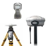
The Trimble R8s GNSS receiver gives advanced satellite tracking with Trimble 360 receiver technology
Includes Trimble Maxwell™ 6 chips with 440 channels; Simple integration with; Trimble S-Series Total Stations; Intuitive Trimble Access™ Field Software; Trimble Business Center Office Software and Trimble DL Android app for collecting static GNSS raw data for post-processing
The Trimble® TSC3 controller with Trimble Access™ software is a handheld field computing solution that streamlines the flow of everyday surveying work and the number of devices you need in the field.
Trimble S7 Total Station
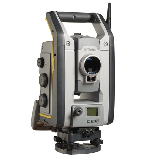
The Trimble S7 Total Station combines scanning, imaging and surveying into one powerful solution. Now you only need one instrument on the job site to perform all your data capture. Create 3D models, high accuracy visual site documentation, point clouds, and more using the Trimble S7.
Features
- Surveying, imaging and 3D scanning in one powerful solution
- Improved Trimble VISION technology for video robotic control, scene documentation and photogrametric measurements
- Trimble DR Plus for long range and superior accuracy
- Locate2Protect real-time equipment monitoring and Trimble InSphere equipment management
- Complete field-to-office solution for quick data capture and processing
- Seamless integration with the Trimble V10 Imaging Rover and GNSS receivers
ULTRA-TRAC® AP

The ULTRA-TRAC® APL Acoustic Pipe Locator finds plastic pipe and systems with missing or broken tracer wire. Natural gas pipelines, water and sewer laterals are easily traced using state-of-the-art acoustic technology.
APL features an integrated tablet which allows the user to view scan data and 3D images of the surveyed underground area. The APL’s on-board software now features improved gain correction to eliminate false-positives. APL will significantly reduce the number of unlocatable pipes and identify potential cross bore risk locations when using HDD.
APL Benefits:
• Locates Pipe through most surfaces
• Easy to use and interpret
• Locates systems in minutes
• No system access required
Materials Located:
Plastic Pipe, PVC, Metallic Pipe, Concrete Pipe, Cast Iron, Ductile Iron, Clay Tile